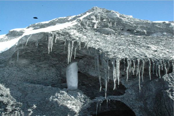
The Amne Machin Snow Mountain, in Golog prefecture, Qinghai, is one of the sacred mountains of the Qinghai–Tibetan Plateau. This important source for the Yellow River – it is the only glacier that feeds into the waterway – is currently receding. This photograph was taken late in the year (in November 2009) but, under the noon sun, the icicles are dripping. Every year, glacier avalanches terrify the locals, who revere the sacred mountain. Local lama Wangqiong says it's a lack of concern for others in the world that is causing the glacier to shrink.
The Sanjiangyuan region of the Qinghai–Tibet plateau contains the headwaters of three of Asia's major rivers: the Yangtze, the Mekong (also known as the Lancang) and the Yellow River. This delicate corner of western China is known as the country's "water tower". But, against the background of economic development and climate change, its high grasslands are quietly changing.
For many years, Hashi Tashidorjee of local NGO the Snowland Great Rivers Environmental Protection Association has been documenting in photographs these changes and their impacts on the lives of local herders.

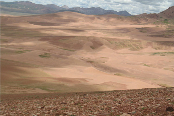
Desertification is visible in Yanzhanggua Valley, Yushu prefecture, on the upper reaches of Sanjiangyuan's Tongtian River. I remember walking on this grassland when I was little and there was no sand back then. There was one pass we used to take to cross the mountain and it was completely clear. Twenty years later, the pass is full of sand and the blockage has created a lake. The Tongtian River – an upper stretch of the Yangtze – flows through this place, and every summer the desert turns the river water yellow. This picture was taken in 2006.

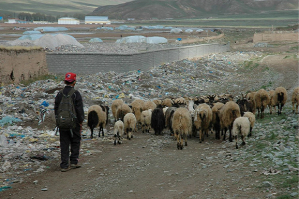
This picture was taken one morning in 2009, before the Yushu earthquake on the Zhaxikecao Grasslands of Yushu. Plastic detritus lies scattered along the roadside, while a shepherd boy walks behind his sheep, a satchel slung on his back.
